
Pierce County Neighbor Sources
A block lookup works best when each source has one role. PublicGIS supplies parcel shapes and public layers. ATIP supplies parcel and tax fields. The Auditor ties recorded parties to land instruments. Election data has strict public-field and use rules. Tacoma's neighborhood councils describe civic geography but do not publish membership rolls. Historical directories can show who was listed at an address in a given year.
| Source | What It Shows About a Block | Access |
|---|---|---|
| PublicGIS | Parcel boundaries, IDs, site addresses and map layers | Free map; scale and links vary |
| ATIP assessor | Taxpayer, site, mailing, value and use fields | Free portal; not an occupancy roll |
| ARMS recorder | Deed parties, liens, plats and recording dates | Index and images vary |
| Voter data | Defined public voter and district fields | Individual task or controlled request |
| Tacoma councils | Council map, meetings and public contacts | Public civic information; no member roster |
| Historical directories | Past address and occupant clues after 1928 | Northwest Room and library resources |
An adjacent parcel is not the same as a next-door person. Renters and other household members usually do not appear in the assessor display. A taxpayer mailing address may be far from the site. Even an owner name needs the recorded instrument before it can support a title conclusion. Keep every Pierce County neighbors search tied to the exact field shown.
Mapping Pierce County Neighbor Parcels
Pierce County PublicGIS offers parcel, address, coordinate, and keyword locate tools. It also provides Identify, measure, coordinates, draw, Street View, hyperlinks, and layers for transportation, places, political areas, public safety, utilities, and the environment. Layer visibility can depend on map scale, and the result is not a legal survey.
- Locate the target street address and note its parcel number.
- Turn on the parcel and relevant boundary layers.
- Click the target and each touching polygon with Identify.
- Carry each parcel number into ATIP and, when needed, ARMS.
The flow is address to parcel polygon to parcel ID to assessor field to recorded deed. Measure and draw tools can help explain frontage or a radius, but they do not prove a property line. For a whole named road rather than one block, use the Pierce County street directory.
Pierce County Neighbor Parcel Fields
The public parcel schema includes a ten-digit TaxAccount, SiteFull, SiteCity, SiteZip5, Ownership, Owner1 and Owner2, MailFull, MailCity, MailZip5, land and improvement values, use code, building quality, exemptions, and plat fields. These labels can help distinguish adjacent sites. They do not list every household member, and the taxpayer name is not automatically legal ownership.
- Parcel
- A mapped unit of land identified by the county for tax and record purposes.
- Site address
- The physical address tied to the parcel.
- Mailing address
- The address used for tax mail, which may be somewhere else.
- Plat
- A recorded map that divides land into lots, blocks, roads, or tracts.
When the site and mailing fields differ, do not infer that the taxpayer lives away from or at the parcel. Use the Auditor's source document if a deed party or legal description matters.
Checking Pierce County Block Owners
After mapping the adjacent lots, search each parcel in ATIP. Keep the site address, mailing address, taxpayer field, use code, and parcel number apart. Next, search the Auditor by names on the document, recording date, or recording number. ARMS is not a basic address search, so the parcel and assessor steps supply the names and legal clues needed for the recorded-document index.
- Save the target parcel and each touching parcel number.
- Compare site and mailing fields in ATIP.
- Search the Auditor for a relevant grantee, date, or recording number.
- Request the source document or certified copy when the index is not enough.
The county says online recorded documents date to 1984. Earlier deeds may require the historical index, counter, mail request, or archives. Parcel-linked documents can be incomplete, and ARMS warns that its redacted images are not a title opinion.
Tacoma Neighbor Council Geography
Tacoma's Neighborhood Council Program lists Central, Eastside, New Tacoma, North End, Northeast, South End, South Tacoma, and West End. These eight independent nonprofits offer public maps, meetings, and contact routes. The city also identifies 15 neighborhood business districts. Neither system is an official parcel boundary or resident-membership directory.
Central and North
Central, North End, and Northeast provide civic area labels and public meeting contacts.
South and East
Eastside, South End, and South Tacoma organize civic participation across distinct areas.
New and West Tacoma
New Tacoma covers Downtown, Stadium, Dome, part of Hilltop, and Port areas; West End has its own council.
See the official council map and list before assigning an address to a council.
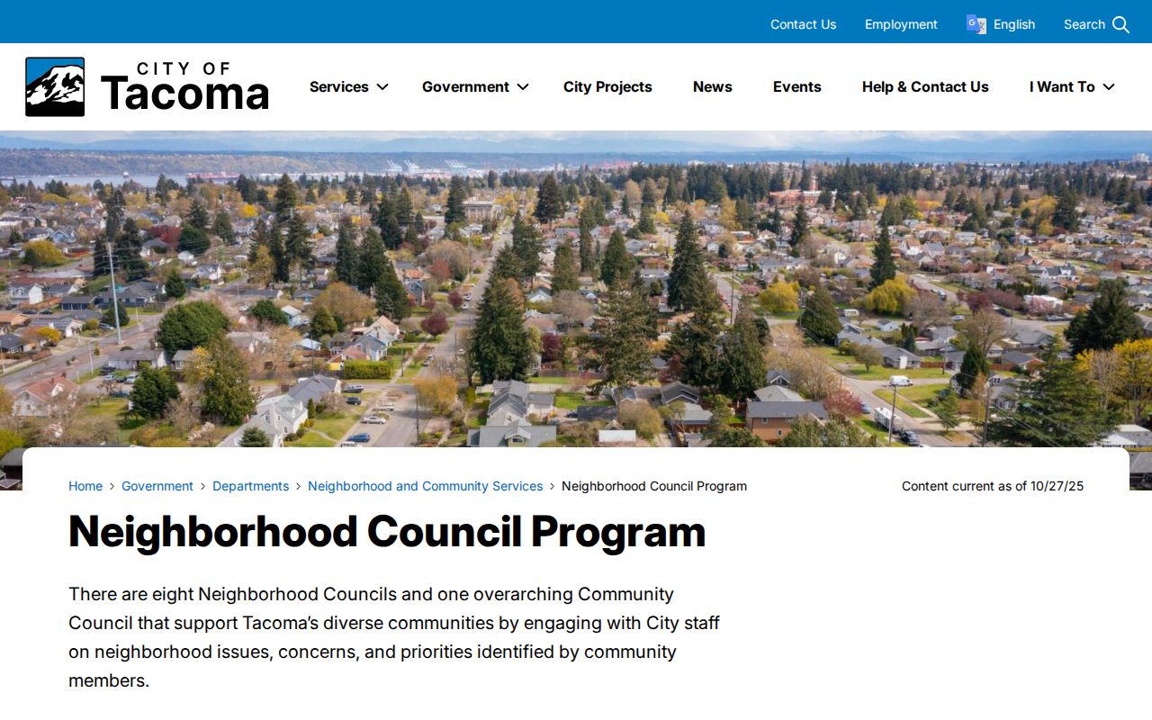
The city page offers civic geography and participation details, not names of everyone who lives in the area.
Pierce County Neighbor Voter Rules
VoteWA is an individual's registration and status task. Block research requiring voter data uses the Secretary of State extract or Pierce Elections request form, which asks for requester details, scope, delivery, and use acknowledgment. Public fields can include name, address, birth year, State Voter ID, districts, precincts, and voting history. Full birth date, driver-license number, and Social Security number stay protected.
RCW 29A.08.740 bars misuse and commercial solicitation. Address Confidentiality Program participants use substitute-address procedures. A voter list also omits nonvoters and should never be presented as a complete roster of Pierce County neighbors. Historical poll books are not available through one verified county portal; Elections, State Archives, and the Northwest Room are the documented fallback chain.
Pierce County Neighbor Tool Choices
Official sources disclose a defined field with a known custodian. Commercial neighbor tools may merge purchased data, public extracts, and inferred links. They can be stale, paywalled, duplicated, or hard to correct. Neither type should be stretched beyond what it proves.
| Source Type | Best Use | Main Limit |
|---|---|---|
| County GIS and assessor | Parcels, site and tax fields | Not a household roster or title opinion |
| Auditor record | Recorded parties and land documents | Index and images may differ |
| Civic council | Public geography, meetings and contacts | No resident membership roll |
| Commercial compilation | Possible lead requiring source checks | May be inferred, stale, or wrong |
Send a field correction to the office that maintains it. Do not average conflicting results into a person profile.
Historical Pierce County Neighbors
Tacoma directories become address-arranged in 1928, creating a strong way to read a past block. Compare one street number with the entries before and after it, then check the nearest census, obituary, newspaper, deed, or Sanborn sheet. The Northwest Room combines city directories, a Buildings Index, Obituary Index, newspapers, maps, photographs, plans, and manuscripts for this work.
A directory entry is a dated clue, not current identity proof. Annexation, changed numbers, removed buildings, or renamed streets may break a simple search. Pair the old address with a Sanborn map and then confirm the present parcel in GIS and Auditor records. This human-history method can reconnect a family with a former block without claiming that the people shown still live there.
Pierce County began in 1852, Steilacoom served as the first county seat, and Tacoma became the seat in 1880. That change matters when an early family or property trail leaves today's online systems. The State Archives Frontier Justice guide places Pierce District Court cases from 1855 through 1889 at the Puget Sound Regional Archives and on microfilm. Record the jurisdiction as it existed on the source date before mapping the place to a current neighborhood.
Pierce County Neighbor Privacy Limits
Renters and other household members are not generally listed in assessor records. Utility and delivery customer lists are not public shortcuts. DMV addresses are restricted by federal law. Washington's Address Confidentiality Program gives qualifying people a substitute address for public workflows, and its real address is tightly protected. Sealed court files, juvenile records, full voter birth dates, and private health facts also remain limited.
Public facts still demand care. Use the least data needed for family history, civic context, property curiosity, or personal safety. Do not publish a block list, infer private ties, or contact someone repeatedly. RCW 9A.46.110 addresses repeated contact, following, or monitoring that causes fear or distress.
Lawful use. Research Pierce County neighbors with care. Never use public data to watch, harass, threaten, intimidate, or harm a person.
If an online field seems wrong, note the parcel, record number, exact field, and source date. Ask the responsible office for its correction or review process instead of spreading the error.